Articles
Thoughts and insights from a team building a weather data platform designed to make complex weather data easier to use.

Meet the Intern Building an AI Fishing Weather App
When most people check the weather before going fishing, they're looking for a simple forecast. Lex Hudson wanted to go a step further. The Central Michigan University meteorology student is spending the summer developing FishCast. This AI fishing weather app combines...

Meet the Intern Building an AI Aviation Weather App
This summer, Wet Dog Weather interns are tackling a unique challenge: building a weather application using AI and real weather data. Antonio McElfresh, a meteorology student at the University of Oklahoma, chose to combine two of his biggest interests, aviation and...

The Hidden Science of Damaging Thunderstorm Winds
Clouds move in accordance with Earth's gravity, and as a result, powerful and interesting phenomena often arise. In this blog post, we will unpack the processes behind damaging thunderstorm winds. In particular: downdrafts, micro- and macrobursts, and squall lines....

What Happens When Interns Build AI-Generated Dashboards?
We have three interns this summer working on AI-generated dashboards using Wet Dog Weather datasets. They've been working for three weeks now, and let's see what they're up to.Air Quality AI-Generated DashboardsWe started them out on an air quality dashboard. A...
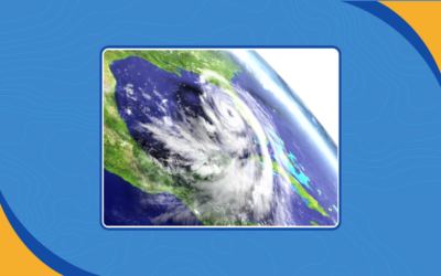
How Hurricanes Form and Why 2026 Could Be Different
A hurricane is effectively a giant soupy heat engine. Like any engine, it needs the right fuel, parts, and conditions to run. Understanding how hurricanes form helps explain why some seasons produce dozens of storms while others struggle to get started. This year, one...
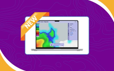
New Weather Data Interpolation Options in Terrier
One of the easiest ways to change how data looks is by changing how it's interpolated. The underlying data remains the same, but the method used to sample and display it can dramatically affect what users see on screen. In this update, we're adding a new weather data...
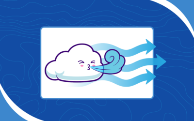
The Ultimate Animated Wind Display (So Far)
We make a visual toolkit for weather called Terrier. It's tied to our own data processing because we need the data processed in a certain way to feed it. It's also much easier to sell a weather data processing platform than it is to sell visualization. One of the...
Tracking the El Niño Weather Pattern in 2026
Recently, we published a blog post to explain global weather patterns. We covered Eulerian and Lagrangian frames, advection, circulation cells, and the jet stream. Now is the time to unpack arguably the most famous teleconnection of all: the El Niño weather pattern....
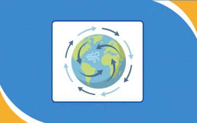
The Mechanics of Global Weather Patterns
The atmosphere is a chaotic place shaped by constantly shifting energy, motion, and global weather patterns that influence conditions across the planet. Meteorologist Lewis Fry Richardson once summed it up this way: “Big whirls have little whirls,That feed on their...
Have a project in mind?
Our weather data platform handles everything from standard datasets to custom data, whether purchased or generated in-house. Customers can have their own Boxer stack with access to Terrier front-end tools, and we provide full support for processing, transforming, and delivering weather information efficiently. Customization is where our expertise shines, helping you get exactly the weather insights you need. Let’s work together to bring your next weather data project to life!