Previous Posts
Goal
Continue improving the Storm Pointer: Chase Command Center by adding a forecast run selection for SPC products and integrating GOES satellite imagery into the dashboard. I’m also adding usable velocity and dual-pol radar.
Workflow
- Researched the best way to display multiple SPC forecast runs.
- Tested a timeline/playback bar but found it wasn’t the best user experience.
- Switched to a simple run selector (+2, +4, +6, etc.) so users can quickly compare different forecast runs.
- Began integrating GOES satellite imagery into the dashboard.
- Worked on correctly displaying GOES East and GOES West imagery based on the user’s selected location.
- Tested image placement and looping while troubleshooting map alignment and animation performance.
Prompts Used
ChatGPT
- Brainstormed different approaches for displaying multiple forecast runs.
- Helped troubleshoot GOES imagery alignment and dashboard functionality.
- Assisted with documenting development progress.
Cursor
- Added selectable SPC forecast runs.
- Implemented GOES satellite imagery.
- Worked on image positioning over MapLibre.
- Improved animation and looping behavior.
- Fixed bugs throughout development.
What Worked
I successfully replaced the playback bar with a run selector, making it much easier to compare SPC forecast runs. I was also able to add GOES satellite imagery to the dashboard. Once I noticed that it was only showing the west satellite, I managed to overlay the satellite imagery flat on the MapLibre map. Surprisingly, nothing outside of this broke while working on these functions.
What Didn’t Work
The playback/timeline bar did not provide a smooth user experience for SPC products, so I changed directions and implemented a run selector instead. The playback/timeline bar was showing past years and dates super fast and not accurately for the satellite loop, but the loop was correct. Initially, GOES imagery always displayed GOES East, even when western locations were selected, so satellite imagery required additional work to align correctly with the map and ensure it was not distorted. I will be working to confirm it is not distorted. Creating a smooth satellite animation loop continues to be a challenge and still needs refinement. The dual-pol and velocity radar need some work in the loop. It certainly isn’t as strong as RadarScope.
Lessons Learned
Sometimes the first solution isn’t the best one. Rather than forcing the playback bar to work, switching to a simpler run selector created a better user experience. I also learned that integrating satellite imagery is more complex than simply displaying an image. Choosing the correct GOES satellite, aligning it accurately with the map, and creating smooth animations all require careful testing to ensure the data is displayed correctly.
Images/Video
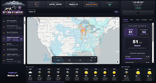
Image showing the different runs of SPC product.
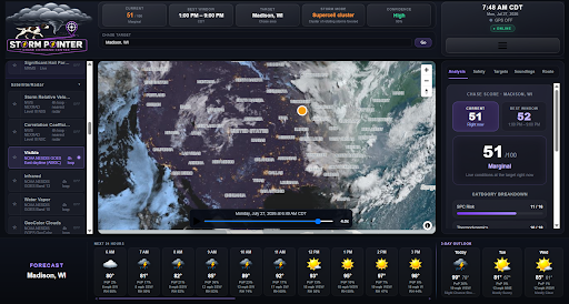
Image of satellite loop
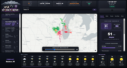
Velocity loop