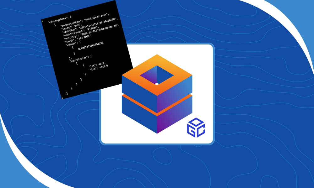
by Steve Gifford | Feb 12, 2026 | Web Coverage Service
We’ve been working on this one for a while, but now it’s ready for prime time. The Web Coverage Service (WCS) is one way to access data directly from our weather data platform and functions as a real-time weather data API for teams that need fast,...
by Steve Gifford | Nov 6, 2025 | Data, GeoService, Web Coverage Service
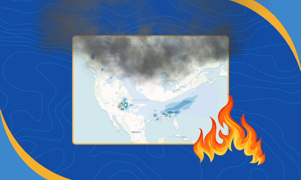
We’re excited to announce that RAP Smoke model data from NOAA is now part of the products we ingest and deliver to our customers. This addition gives developers and analysts a new way to visualize smoke movement and density across North America. It is especially...
by Steve Gifford | Oct 16, 2025 | GeoService, Web Coverage Service
I work a lot with open standards and on AWS. I’ve been thinking about how some of the standards we depend on result in open-ended queries, and how I wish they were more like some of the AWS services we use to build those services. That’s especially true...
by Steve Gifford | Sep 18, 2025 | Labrador, Web Coverage Service
The Web Coverage Service (WCS) is an OGC standard for retrieving time-series gridded data sets. It has a strong weather and climate focus, and that’s mostly who uses it. I say that as if it’s a well-known standard… it’s really not. Most weather...

by Steve Gifford | Jan 29, 2025 | Labrador, Web Coverage Service
We recently enhanced our geospatial capabilities by implementing a cloud-based WCS in our Labrador rollout. This modern approach combines the power of cloud infrastructure with established OGC standards, delivering scalable access to geospatial data. Let’s...