GeoService
GeoService: Fast, Flexible Map Services From Our Weather Data Platform
- Supports OGC standards WMS and WMTS
- Dynamic map rendering with flexible layers, styles, and metadata
- Cached tiles for fast pan and zoom performance
- Time-enabled layers for forecasting and historical data

GeoService is a standards-based component of the Wet Dog Weather weather data platform, providing reliable map services for delivering weather data. It supports WMS for dynamic map rendering and WMTS for cached tiles, enabling fast panning and zooming. GeoService is well-suited for interoperability and simple map delivery when standards compliance is required, while more advanced, interactive visualization is handled by Terrier.
White Papers

GeoService Posts
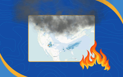
New RAP Smoke Model Data from NOAA Now in Our Stack
Wet Dog Weather is now ingesting RAP Smoke model data from NOAA. This addition helps developers, analysts, and app builders visualize smoke movement and improve air quality insights in their applications.
Smarter Query Design with OGC Services and AWS
If you’ve ever pulled data from OGC services, you know how easily one request can snowball into a flood of XML. In this post, we examine why open-ended queries persist, how AWS handles large results differently, and what the geospatial community could learn from that approach.
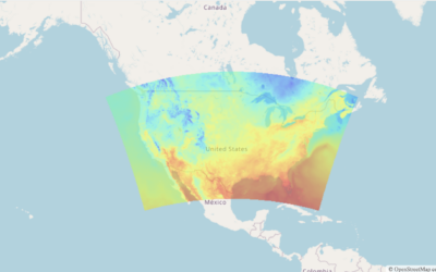
Find Out Why Our Weather Map Tiles Are So Fast
Our weather map tiles deliver fast weather data visualization. Our commitment? Ensuring weather map tiles load rapidly yet efficiently. Discover how we do this.
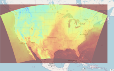
Powerful Static Tile Service For Seamless Mapping
Our Static Tile Service is designed to provide developers with an efficient and reliable solution for visualizing and caching map tiles while adhering to OGC-compliant WMS and WMTS standards.
Industries
Automotive
Aviation
Consumer
Utilities
Have a project in mind?
Our weather data platform handles everything from standard datasets to custom data, whether purchased or generated in-house. Customers can have their own Boxer stack with access to Terrier front-end tools, and we provide full support for processing, transforming, and delivering weather information efficiently. Customization is where our expertise shines, helping you get exactly the weather insights you need. Let’s work together to bring your next weather data project to life!