
by Steve Gifford | Jun 25, 2026 | Terrier
We have four interns this summer working on AI-generated dashboards using Wet Dog Weather datasets. They’ve been working for three weeks now, and let’s see what they’re up to. Air Quality AI-Generated Dashboards We started them out on an air quality...
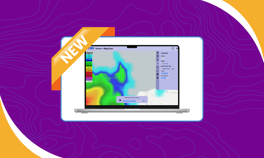
by Steve Gifford | Jun 11, 2026 | Terrier
One of the easiest ways to change how data looks is by changing how it’s interpolated. The underlying data remains the same, but the method used to sample and display it can dramatically affect what users see on screen. In this update, we’re adding a new...

by Steve Gifford | Jun 4, 2026 | Terrier
We make a visual toolkit for weather called Terrier. It’s tied to our own data processing because we need the data processed in a certain way to feed it. It’s also much easier to sell a weather data processing platform than it is to sell visualization. One...

by Steve Gifford | May 7, 2026 | Data, Terrier
We pride ourselves on processing a wide variety of observational and model data. Years ago, we started with the standard National Weather Service models and NEXRAD radar you’ll see in weather apps. Since then, we’ve added a wide variety of specialized data...

by Steve Gifford | Apr 30, 2026 | Web Coverage Service
We launched our future radar product a few weeks ago, and it’s going great. The visual side looks good and should serve our customers well. Now we’re digging into the data side, specifically how future radar WCS queries work in practice. Let’s take a...