Some of the most extreme conditions on Earth are experienced within mountains. Mt. Washington, NH, for example, experiences some of the harshest weather on the continent. It has an annual average wind speed of 35 mph and holds the record for the second-highest wind ever observed on Earth’s surface at 231 mph. From early mountaintop observatories like Austria’s Sonnblick to modern research stations across the Rockies and Alps, scientists have long been fascinated by how air behaves in these environments. The legacy of observation raises a fundamental question: why are mountain wind patterns so dynamic?
Two Types of Mountain Wind Patterns
Winds amidst mountains generally fall into two categories: terrain-forced and thermally driven flow. The former is intuitive: wind hits an obstacle and is deflected. The latter is more subtle, involving daily cycles of heating and cooling.
Terrain-forced Flow
When an approaching airflow encounters an obstacle, several factors determine the downstream response: wind speed, atmospheric stability, and the orientation of the terrain relative to the incoming flow.
Air impinging on a mountain slope may be channeled down a valley or deflected upward, giving rise to orographically driven clouds that can produce strong thunderstorms if the conditions are favorable.
When strong upper-level winds encounter a mountain range, the topographic imprint often becomes visible in the wind field from numerical weather models. The image below, generated in Terrier using the High-Resolution Rapid Refresh (HRRR) model, displays 80-meter winds over the Appalachian Mountains.

As air is deflected upward and expands, gravity and buoyancy pull it back down, creating oscillations that ripple through the atmosphere. On the leeward side, these oscillations can form rotor wakes, which are particularly hazardous for pilots. Meanwhile, the windward slopes provide ample lift, making them ideal for gliders and research aircraft studying high-altitude turbulence.
Thermally Driven Flow
Distinct from terrain-forced flow, but often superimposed on existing flow, are thermally driven mountain wind patterns.
During the day, solar radiation heats the mountain slopes faster than the valley floor. This creates a pressure gradient that drives upslope and up-valley winds. At night, radiative cooling reverses the process. The cooled, denser air drains downslope as katabatic flow, pooling in valley bottoms and creating strong temperature inversions where cold air is trapped beneath warmer layers.
If you have ever wondered why valleys get so cold at night, this is part of the reason. That trapped layer also explains why fog or smog lingers after sunrise. It takes time for the sun to erode the inversion and restore vertical mixing.
Mountain Venting and Vertical Transport
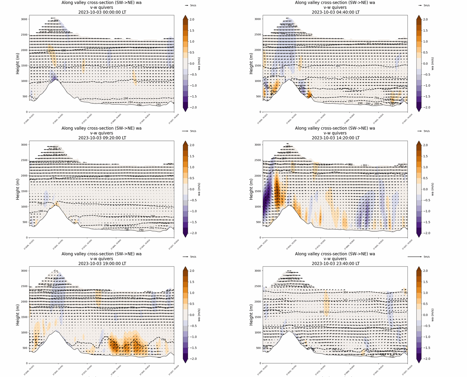
Another fascinating behavior in mountain environments is mountain venting, where the combined upslope flow induces a quasistationary updraft near mountain peaks.
The image below shows vertical wind fields from a run of the Weather Research and Forecasting (WRF) model. Between 1000 and 1400 local time (LT), a coherent orange flare marks the region where air is venting momentum, moisture, and particulate matter into higher layers of the atmosphere.

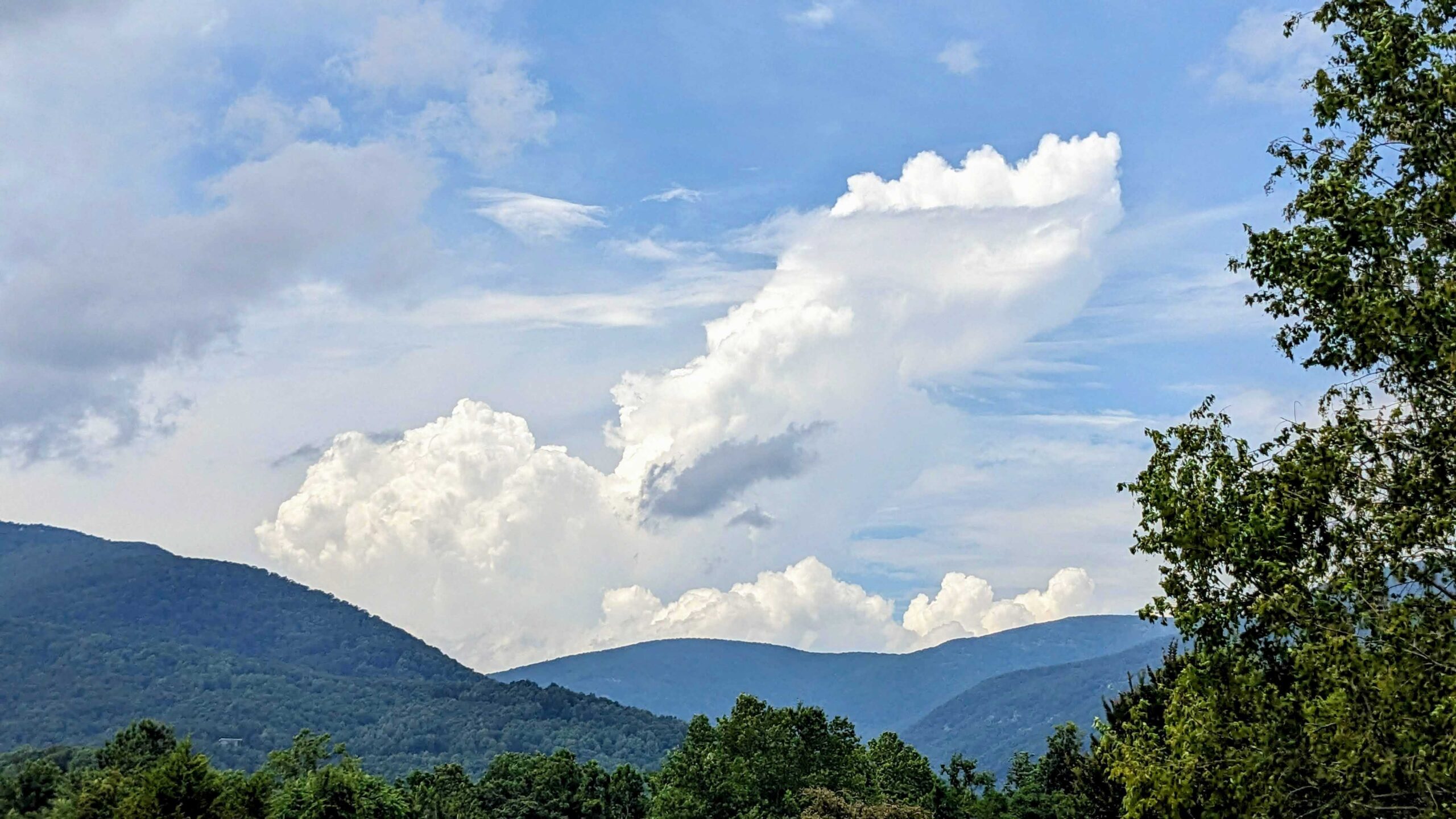
Alongside terrain-induced flow, this venting may also contribute to the development of thunderstorms. As the rising air hits the lifting condensation level, where air temperature equals dew point, clouds form. The process releases latent heat, increasing buoyancy and fueling upward motion.
The following image shows towering cumulus clouds forming over the Blue Ridge Mountains of Virginia, visual proof of how mountain wind patterns help shape afternoon convection.

Why Mountain Wind Patterns Matter
Ultimately, the flow over mountains is never simple. Each ridge, valley, and slope shapes the air in unique ways. The study of mountain wind patterns continues to challenge scientists, as even subtle shifts in terrain or stability can produce dramatically different results.
Modern research, which combines high-resolution modeling, remote sensing, and field observations, is revealing these dynamics in greater detail. Tools like Boxer and Terrier enable the visualization of these interactions, allowing for the refinement of forecast accuracy in complex landscapes.
Each new insight into mountain wind patterns brings us closer to accurately representing one of the atmosphere’s most intricate and influential environments.

