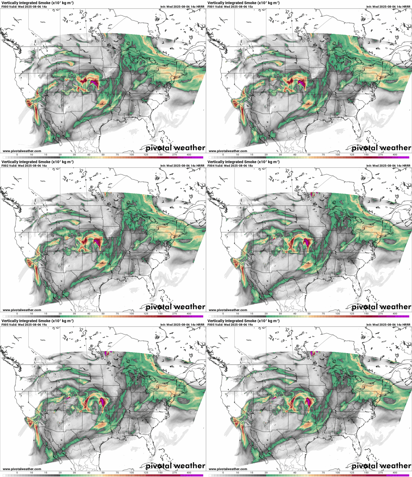
When wildfires break out, the flames aren’t the only concern; where the smoke goes can have massive downstream impacts on health, travel, and response coordination. That’s where smoke transport modeling comes in. The High-Resolution Rapid Refresh (HRRR) HRRR-Smoke model, developed by NOAA, is one of the most widely used tools for forecasting smoke movement across the entire United States.
This model is initialized four times each day and generates hourly 3km-resolution forecasts that show how smoke plumes evolve in space and time. It uses data from satellite-mounted optical and infrared sensors to monitor fire activity and simulate how smoke moves through the atmosphere, even over long distances.
A Look Inside the Model
At the core of HRRR-Smoke’s functionality is the ability to ingest satellite data from instruments like VIIRS (Visible Infrared Imaging Radiometer Suite) and MODIS (Moderate Resolution Imaging Spectroradiometer). These instruments measure Fire Radiative Power (FRP), the heat signature from active fires, and detect where fires are burning intensely enough to produce large volumes of smoke.
From there, HRRR-Smoke uses complex atmospheric chemistry and wind fields to model how that smoke moves. It also computes vertically integrated smoke densities, which are crucial in understanding not just where smoke is going horizontally, but how high it’s reaching in the atmosphere, an essential factor in determining long-range transport.

Smoke Data in Relation to Wildfire Sources
One of the lesser-known benefits of smoke data is how it helps estimate the size and spread of fires themselves. Satellite sensors often can’t “see” the heat signature from fires when thick smoke is overhead. But the plumes themselves, dense clouds of particulates, offer a useful proxy. By analyzing the movement and intensity of smoke, HRRR-Smoke can help fill in the gaps where direct fire detection fails.
This is another area where smoke transport modeling becomes valuable. Even when thermal imagery is blocked, plume dynamics modeled by HRRR-Smoke offer insight into wildfire extent, fire behavior, and burn intensity, especially for decision-makers who don’t have eyes on the ground.
Why Smoke Transport Modeling Matters
The importance of smoke transport modeling goes beyond fire lines. Once smoke reaches higher altitudes, particularly above the surface boundary layer, it can travel hundreds or even thousands of miles, affecting air quality in distant cities and rural communities. HRRR-Smoke tracks these vertical movements and simulates how smoke interacts with upper-level wind currents and terrain features, such as mountain ranges or valleys.
These forecasts are essential for:
- Public health agencies, which need lead time to issue air quality warnings
- Aviation operations, especially in regions where visibility and turbulence are impacted
- Power utilities and transportation, which rely on atmospheric models to plan safety protocols
- Fire management teams, who must anticipate smoke behavior when allocating resources
Bringing it All Together
At Wet Dog Weather, we help our clients visualize complex model outputs, whether through custom dashboards, alerting tools, or embedded maps. Tools like HRRR-Smoke don’t just model smoke; they offer insight into wildfire dynamics, air quality, and risk far from the source. The model’s high-resolution, high-frequency updates make it ideal for applications that demand precision and timeliness.
Whether you’re managing wildfire response, concerned about community safety, or looking to incorporate smoke transport modeling into your tools, we can help you visualize it in a way that makes sense.

